Page 116 of 278
Re: FORGOTTEN CORNERS
Posted: 10 Oct 2017, 08:49
by Tripps
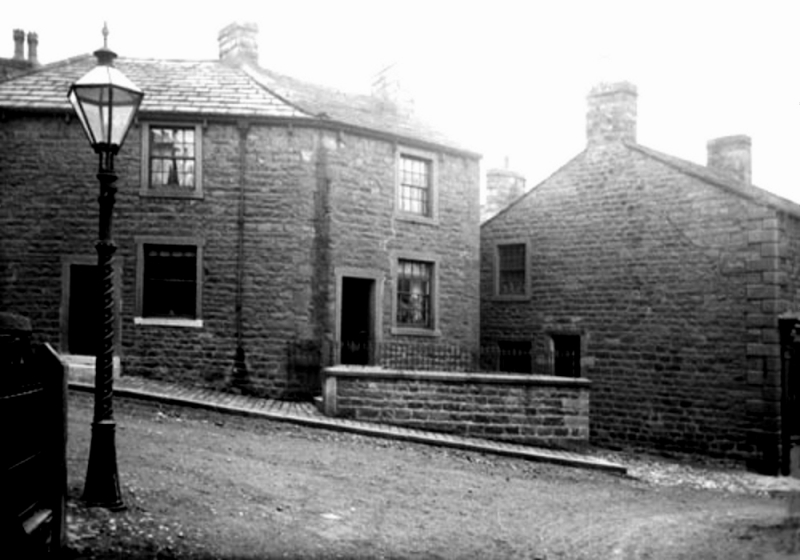
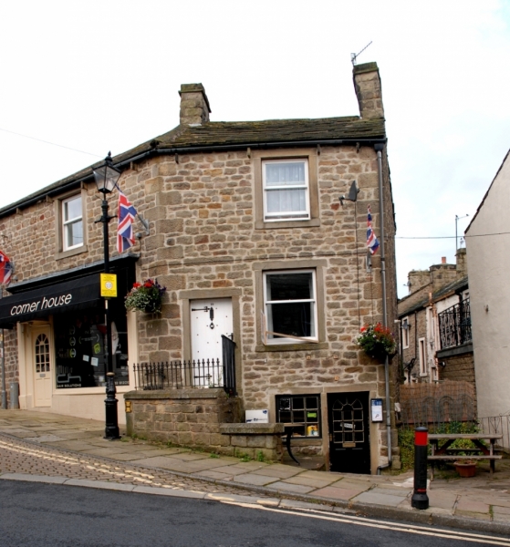
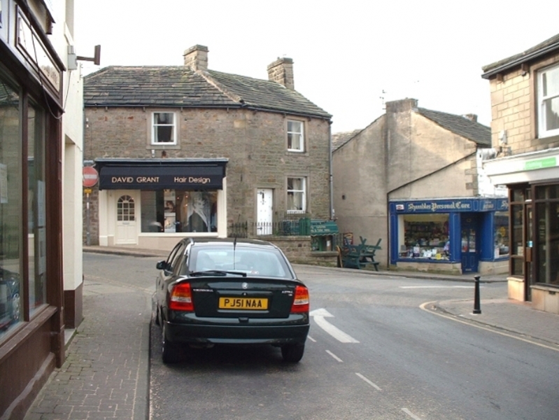
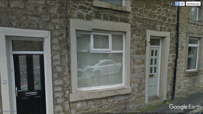
Sue - yes it seems to be still there and in good order. Is it 'The Butts' or just 'Butts'?
Here's a guided tour.
 11 Butts
Re: FORGOTTEN CORNERS
Posted: 10 Oct 2017, 08:54
by PanBiker
Sue wrote: ↑10 Oct 2017, 07:11
Is. 11 The Butts still there. It was a Widdup family home at one point, its on a couple of censuses
Yes it is Sue, here is Butts looking down from the top. Number 11 is on the right hand side about half way down.
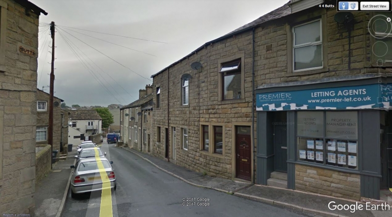
Here it is
Re: FORGOTTEN CORNERS
Posted: 11 Oct 2017, 03:25
by Stanley
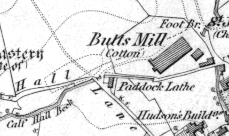
Here's Butts Mill on the First Edition OS in 1853. If you look in the road you can see that the beck surfaces in the middle of the road. This was where the tail water from Calf Hall Beck which was culverted under the mill met Gillians Beck which comes in from the South down the back of the Pigeon Club. I have a clear memory of seeing a walled enclosure in the middle of the road some time in the late 1950s but have never seen a pic of it and half wonder if it is a false memory but I don't think so.
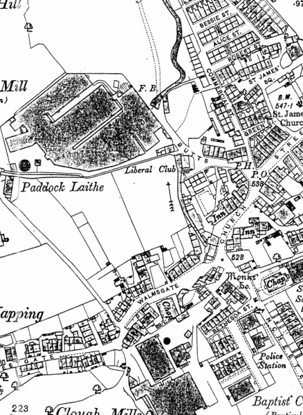
In 1892 there was the same arrangement with a footbridge marked over the beck.
Re: FORGOTTEN CORNERS
Posted: 11 Oct 2017, 06:58
by Sue
Thank you all, so nice to see. Recently i identified a house in Rochdale on Syke common for a very distant relative in Australia. A widdup family lived there in the 1841-1861 censuses. It too is in very good order.
Re: FORGOTTEN CORNERS
Posted: 11 Oct 2017, 07:03
by Sue
Tripps wrote: ↑10 Oct 2017, 08:49
Sue - yes it seems to be still there and in good order. Is it 'The Butts' or just 'Butts'?
Here's a guided tour.
11 Butts
Thank you for this Stanley, I think John Widdup would be shocked, its the house where he was born
Re: FORGOTTEN CORNERS
Posted: 12 Oct 2017, 02:35
by Stanley
Isn't it funny how things suddenly become clear. I have been looking at the name Green Street for over fifty years and it has only just struck me that the most likely reason for the name is that the block between it and Church Street used to be the old Village Green.
Re: FORGOTTEN CORNERS
Posted: 12 Oct 2017, 09:36
by PanBiker
Stanley wrote: ↑12 Oct 2017, 02:35
Isn't it funny how things suddenly become clear. I have been looking at the name Green Street for over fifty years and it has only just struck me that the most likely reason for the name is that the block between it and Church Street used to be the old Village Green.
I can't quite believe the penny has only just dropped Stanley. I am sure you have mentioned it in the past in relation to Wellhouse Farm, and the orchard that gave its name also to the street we have now along with the adjacent market. I would assume that with the Green Street cottages being early 19C the green would have actually extended from the front of the older cottage properties of St James Square sitting at the head of the Croft.
Re: FORGOTTEN CORNERS
Posted: 13 Oct 2017, 03:55
by Stanley
You could be right Ian but if I did I forgot it.... Perhaps my head's finally getting full.
Another forgotten corner connected with Butts is a thread we had on the old site about the origin of the name, usually connected to compulsory medieval archery practice. I've always doubted that and we had a conversation about some cottages called Herriff Butts. Another usage of 'butts' is a descriptor for fields in a medieval field system and Herriff is the name of a pernicious weed so I thought that was perhaps the way Butts got its name. I the end I think many of us agreed that this was probably the correct origin and that all the land on the ridge stretching North from the old village green was a field system. Croft could be another remnant from that as it is a small field.
Re: FORGOTTEN CORNERS
Posted: 13 Oct 2017, 08:32
by PanBiker
Wasn't Valley Gardens allotment land at one time? I think the section from the end of our street and in front of Far East View was. Probably much later usage but not uncommon from the transition from a previous field system after they built the terraces on the hill.
Re: FORGOTTEN CORNERS
Posted: 14 Oct 2017, 03:37
by Stanley
I don't know Ian but I do know there were market gardens down there. Harold Duxbury mentioned them. Also, some greengrocers in the town had holdings down there to supply their shops. There were stables as well and I bet that the dung from them was used locally.
Re: FORGOTTEN CORNERS
Posted: 15 Oct 2017, 06:04
by Stanley
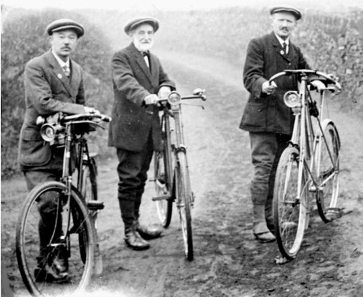
A favourite old image. The middle man is I think Leonard Holdsworth. The others will almost certainly be manufacturers. This would be about 1900 when cycling was a very popular pastime.
Re: FORGOTTEN CORNERS
Posted: 16 Oct 2017, 03:51
by Stanley
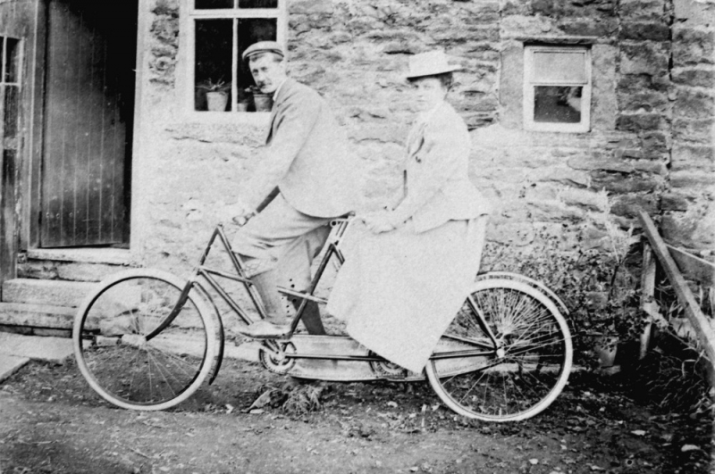
Fred and Elizabeth Bracewell on their tandem at about the same time.
Re: FORGOTTEN CORNERS
Posted: 17 Oct 2017, 05:25
by Stanley
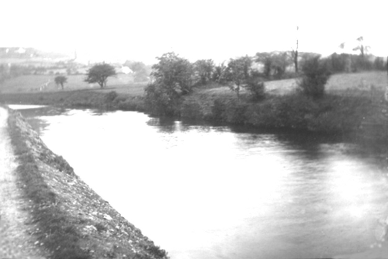
This corner is so forgotten that I don't know where it is. I've always suspected that that's Foulridge in the background but I can't be sure. Anyone got any ideas?
Re: FORGOTTEN CORNERS
Posted: 17 Oct 2017, 07:38
by plaques
Looks a bit like the open air pool at Shortbank Rd Skipton. Can't be sure though, before my time.
Re: FORGOTTEN CORNERS
Posted: 17 Oct 2017, 08:24
by PanBiker
Not Shortbank pool Plaques but it could be the canal on the approach to Foulridge also very similar to the section just before the winding hole coming towards Barlick between the plantation and the turnover bridge.
Re: FORGOTTEN CORNERS
Posted: 18 Oct 2017, 03:57
by Stanley
It's bothered me for years. It was in a collection I was lent that were otherwise all Barlick pics. I did wonder whether the negative had been reversed, that's fooled me before but it doesn't help.
Re: FORGOTTEN CORNERS
Posted: 18 Oct 2017, 08:28
by PanBiker
Looking at it again, there are very few places on the canal locally that have a high sloping bank. That would rule out both of my last suggestions. Once such place though would be the stretch just past the Anchor but the banking there is much higher, it does shallow out nearer the bend before the boathouse though. I'm walking the tow path in my mind from Bank Newton to the Mile Tunnel, I have sat on the banking fishing on all lengths over the last 50 years.
Re: FORGOTTEN CORNERS
Posted: 18 Oct 2017, 11:46
by chinatyke
Canalunknownflip (2).jpg
This is the image reversed.
The road in the background looks to me to be the road up Slipper Hill (have I got the name right?) going out of Foulridge onto Whitemoor Res and the top road to Barlick. So could this be taken from the canal somewhere near the bottom of Slipper Hill? I suppose that would be somewhere near to the north end of the mile tunnel.
Re: FORGOTTEN CORNERS
Posted: 19 Oct 2017, 02:39
by Stanley
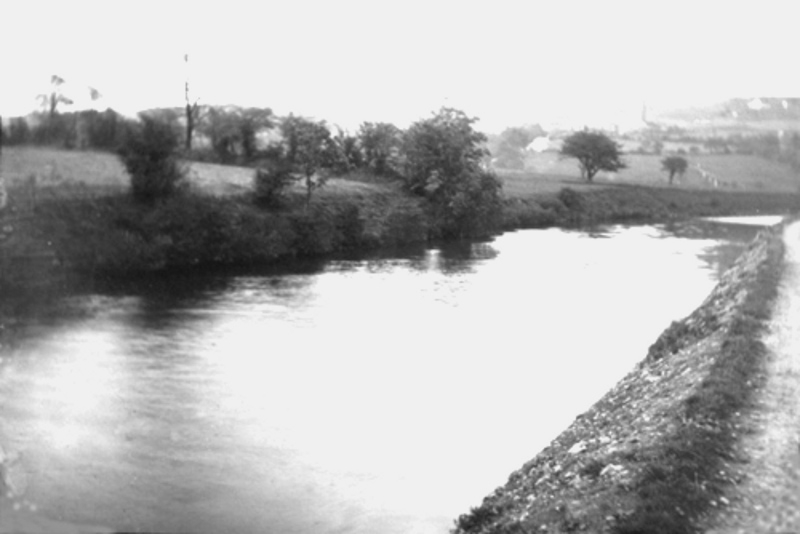
It looks better that way round for some reason. I have a feeling that near Foulridge is the right answer.
Re: FORGOTTEN CORNERS
Posted: 20 Oct 2017, 06:51
by Stanley
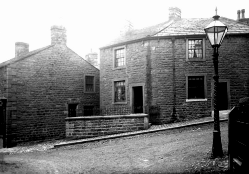
Here's a pic that puzzled me for years until I realised it was reversed and was actually the junction of Newtown and King Street. However, what interests me this morning is the lamp post. I often think that one of the biggest mistakes we made was to ditch all the old cast iron lamp posts and replace them with concrete monstrosities. I know the reasons but still regret their passing. Ironically the last twenty years have seen a rash of cast iron street furniture, much of it trying to imitate the old lamps.
Re: FORGOTTEN CORNERS
Posted: 20 Oct 2017, 08:59
by plaques
Back to the canal scene, I wouldn't dismiss China's suggestion too lightly. I don't think its Slipper Hill res: (Old Ebbies) but it could just be a view from somewhere near the locks looking towards Red Lane before you get to the tunnel. Why would someone go to all the trouble and expense of taking a view of a bit of canal in the first place? Were they setting up for the next shot which may have included a barge? Have you any other images that are barge scenes Stanley?
On the lamp posts, Winewall in Trawden still have a number of the old cast iron lamps. Nelson council tried to 'relocate' them into Nelson centre to give it a more nostalgic look. Winewall took umbrage at the suggestion, " we have only still got them because you've ignored any improvement in the area for umpteen years, Bugger off"!! Quite right too.
Re: FORGOTTEN CORNERS
Posted: 20 Oct 2017, 10:14
by PanBiker
Stanley wrote: ↑20 Oct 2017, 06:51
Here's a pic that puzzled me for years until I realised it was reversed and was actually the junction of Newtown and King Street.
Not sure about that Stanley, the window in the gable is in the wrong place and the cornerstones are wrong for the last building on Rainhall Road. It would have to have been before Craven House was built and the road to the right looks a bit steep to me for King Street.
The canal photo cant be looking the other way towards Red Lane as there are no buildings in the background from that viewpoint and the banking running up to the tunnel is a lot steeper than shown. Pity it's not just a bit clearer. It's on the outskirts somewhere but as I commented earlier sloping banks are a bit thin on the ground.
Re: FORGOTTEN CORNERS
Posted: 21 Oct 2017, 02:39
by Stanley
Re: FORGOTTEN CORNERS
Posted: 21 Oct 2017, 08:20
by PanBiker
I hold my hand up Stanley, I thought you had already reversed it as that's how it read.
Re: FORGOTTEN CORNERS
Posted: 22 Oct 2017, 04:13
by Stanley
Sorry if I wasn't clear. One valuable thing about the puzzle was that it taught me to always consider the possibility of reversal, printing the negative the wrong way round. It's so easy to do and I suspect it's a common error with old prints.
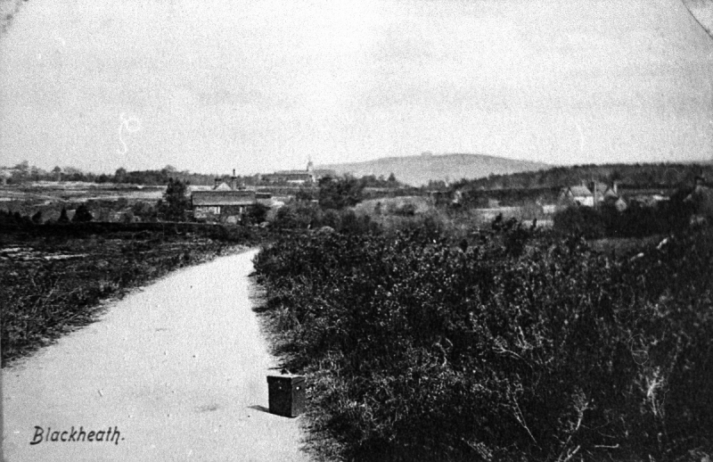
Here's another error. Blackheath Common postcard around 1890. Spot the mistake!